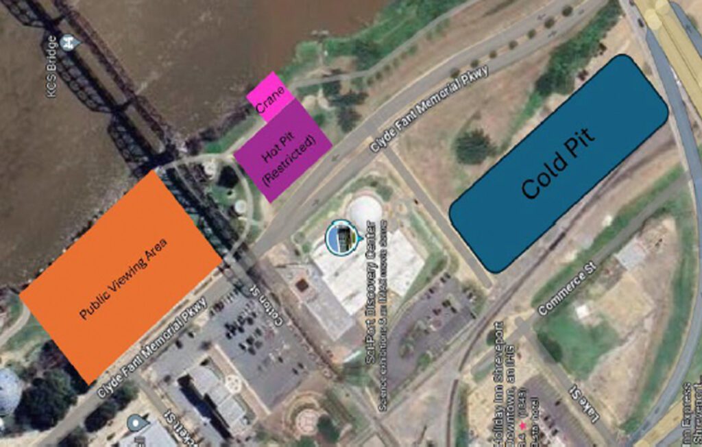

An aerial/satellite view of the northern section of the event venue near Clyde Fant Memorial Pkwy. An orange rectangle on the west side of the river marks the Public Viewing Area. A magenta/pink rectangle near the riverbank is labeled “Hot Pit (Restricted)” with a crane nearby. A large teal/blue rectangle to the northeast is labeled “Cold Pit.” The Sci-Port Discovery Center is visible in the center of the image. Streets visible include Clyde Fant Memorial Pkwy, Cotton St., and Commerce St.